Poverty Point State Historic Site, located in northeastern Louisiana, holds a unique place in American archaeology. This prehistoric earthwork was constructed by the ancient Poverty Point culture, which extended its influence across the Southeastern Woodlands of the Southern United States.
This culture covered a vast territory, spanning 100 miles across the Mississippi Delta and south to the Gulf Coast. It’s a remarkable site of archaeological significance and is recognized as a state historic site, a U.S. National Monument, and a U.S. National Historic Landmark. Here’s a brief overview of Poverty Point:
Poverty Point World Heritage Site
At a distance of 15.5 miles from the Mississippi River, Poverty Point is perched on the edge of Macon Ridge, and in its proximity, the village of Epps developed in later periods. The complex itself consists of earthen ridges and mounds, constructed by indigenous people during the Late Archaic period, specifically between 1700 and 1100 BCE.
Its multi-functionality is a topic of ongoing research, with potential roles as a settlement, trading center, and ceremonial religious complex among the proposed functions. The centerpiece of Poverty Point comprises a series of earthen ridges, mounds, and a central plaza, forming a unique geometric design that became apparent through aerial photographs.
The six concentric C-shaped ridges, separated by swales, are distinct from Poverty Point. Although the ridges’ height and width have been affected by centuries of plowing, archaeologists believe they were once taller and more massive. Radiocarbon dating suggests the ridges were constructed between 1600 and 1300 BCE. The central plaza, encompassed by the innermost ridge, has been significantly modified, with evidence of wooden posts hinting at their integral role in the site.
Poverty Point’s construction was a gradual, multi-generational effort that began as early as 1800 BCE and continued until 1200 BCE. Prehistoric workers first leveled the land, filled gullies, and prepared surfaces for mounds and ridges. Loess soil, easy to dig but susceptible to erosion, was the primary construction material. The actual construction involved filling gaps between dirt piles, and it’s believed that people of all ages participated in this massive effort.
The site is significant for its preservation and integration of various earthworks, the intactness of the complex, and the fact that it was constructed by hunter-fisher-gatherers, making it a rare example of monumental earthworks built by a non-agricultural society. The location of Poverty Point on Macon Ridge, overlooking Bayou Maɫon, was chosen due to the natural topography that provided a secure settlement area and influenced the site’s layout.
The significance of Poverty Point isn’t only in its form but also in the sophistication with which its builders utilized natural features and topography to create a purposeful, designed monumental landscape. The vast amount of earth rearrangement beneath the visible structures holds untold information about the site and its builders.
The surroundings, including Bayou Maɫon, provide insights into the natural environment during the site’s construction. In summary, Poverty Point is a testament to the ancient culture that created it and an invaluable archaeological site offering a window into prehistoric America.
Poverty Point Louisiana Facts
Poverty Point State Historic Site, a UNESCO World Heritage Site, is an ancient earthwork located in northeastern Louisiana, USA, and is a remarkable archaeological treasure. Here’s a concise summary:
1. Ancient Earthwork: Poverty Point is an ancient earthwork complex built by indigenous peoples more than 3,000 years ago. It is considered one of the most important archaeological sites in North America.
2. Cultural Significance: The site is associated with the ancient Poverty Point culture, which extended over 100 miles in the Mississippi Delta and Gulf Coast regions.
3. Earthwork Complex: The complex consists of earthen ridges, mounds, and a central plaza, built between 1700 and 1100 BCE during the Late Archaic period.
4. Monumental Construction: The construction of the earthen mounds and ridges at Poverty Point is a remarkable feat of ancient engineering, as it required moving enormous amounts of earth using primitive tools.
5. Multiple Functions: It is believed that the site was a hub for trading goods from different regions, including copper, stone, and marine shells. Various uses for the site have been suggested by archaeologists, including settlements and ceremonial religious complexes.
6. Circular Magnetic Features: Geophysical surveys uncovered large post circles in the central plaza, indicating the presence of wooden posts alongside the earthworks’ construction.
7. Gradual Construction: Poverty Point’s construction occurred over several generations, between 1800 and 1200 BCE, using loess soil, which was capped with clay to protect it from erosion.
8. Community Effort: The earthworks were constructed through collaborative efforts, with men, women, and children participating in this massive undertaking.
9. Environmental Changes: Changes in temperature, precipitation, and flooding may have contributed to the site’s eventual abandonment, marking a transition between the Archaic and Woodland periods.
10. Mound Complex: At the heart of Poverty Point is a complex of earthen mounds and concentric ridges that form a bird-shaped design when viewed from above. This design includes six major mounds and several smaller ones.
11. Age and Culture: The site dates back to the Late Archaic period and is associated with a prehistoric Native American culture. It is believed to have been inhabited and used for ceremonial and trade purposes.
12. Unique Geometric Layout: The geometric layout of Poverty Point’s mounds and ridges, resembling a bird or butterfly when viewed from above, sets it apart from other ancient earthworks in North America.
13. Natural Landscape: The site’s location on an elevated ridge overlooking Bayou Maɫon helped protect against flooding and influenced the design of the complex.
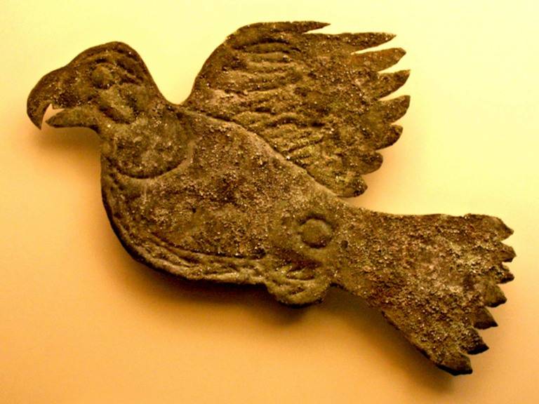
14. Artifacts: Archaeological excavations at the site have unearthed a wide range of artifacts, including pottery, stone tools, and ornaments, shedding light on the culture of the people who lived there.
15. Archaeological Importance: Poverty Point’s elements, including mounds, ridges, the plaza, and more, showcase a meticulously designed monumental landscape recognized for its historical and archaeological importance.
16 Monumental Earthworks of Poverty Point: In 2014, Poverty Point was designated as a UNESCO World Heritage Site due to its global archaeological significance.
17. Visitor Center: Visitors to Poverty Point can explore the site and learn about its history and significance at the on-site visitor center.
Poverty Point State Historic Site is a testament to the ancient engineering and cultural accomplishments of the Native American people who lived there and provides insightful information into early Native American culture. It is a UNESCO World Heritage Site in northeastern Louisiana, USA, and is also a location for archaeological exploration and interest for those who are interested in early North American history.

